History
The Blakeley Raise Stone Circle, also known as the Kinniside Stone Circle, is a reconstructed stone circle located in the civil parish of Ennerdale and Kinniside in Cumbria, England. The circle is situated next to the fell road from Ennerdale Bridge to Calder Bridge in Cumbria. While it is not known precisely when the circle was originally built, it is believed to date back to the Bronze Age or Neolithic period.
Bronze Age
During the Bronze Age, people in Britain began to build stone circles as part of their religious and cultural practices. These circles were often used for ceremonies, rituals, and astronomical observations. The Blakeley Raise Stone Circle is one of many such circles that were built during this time period.
Neolithic
The Neolithic period, also known as the New Stone Age, saw the development of agriculture and the domestication of animals. During this time, people in Britain continued to build stone circles, often using massive stones that were transported over long distances. The purpose of these circles is not entirely clear, but they are believed to have had religious or spiritual significance.
18th Century
In the 18th century, the Blakeley Raise Stone Circle was described by the antiquarian William Stukeley. Stukeley noted that the circle was in a state of disrepair, with many of the stones lying on the ground. In the early 20th century, a restoration project was undertaken to reconstruct the circle. However, the accuracy of this reconstruction is uncertain, and some have suggested that the circle is not original at all, but is a modern replica.
Overall, the Blakeley Raise Stone Circle is an important prehistoric site in England, and it provides valuable insights into the religious and cultural practices of people in Britain during the Bronze Age and Neolithic periods.
Location
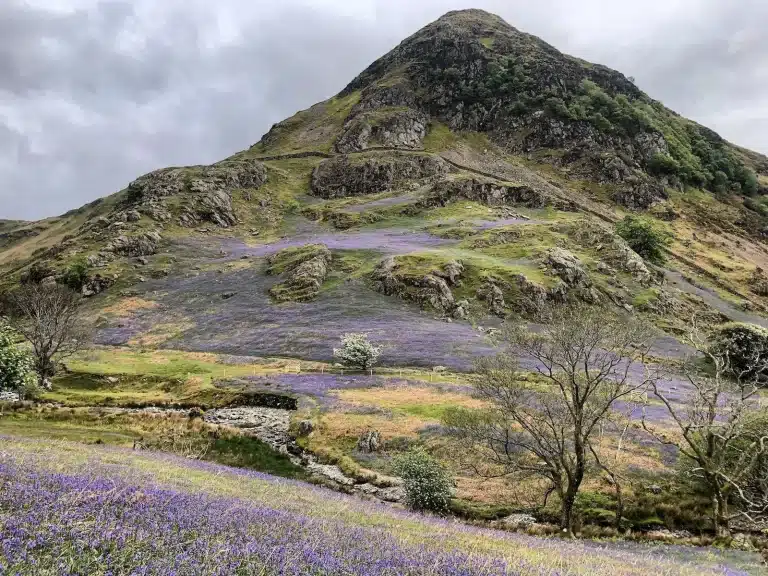
The Blakeley Raise Stone Circle is located in the civil parish of Ennerdale and Kinniside in West Cumbria, England. It is situated on the Blakeley Raise hill, which is a gentle, dome-shaped hill joined to the north-east to Heckbarley, a subsidiary summit of Grike. The stone circle is located on the lower western slopes of Blakeley, which include an area of wetland known as Blakeley Moss. The northern slopes of the hill are heavily forested.
Directions
The Blakeley Raise Stone Circle is easily accessible by car. Visitors can take the minor road south of Ennerdale Bridge towards Hailes and park on the roadside. The stone circle is located next to the fell road from Ennerdale Bridge to Calder Bridge in Cumbria. Visitors can use the Ordnance Survey maps to locate the stone circle.
Coordinates
The coordinates of the Blakeley Raise Stone Circle are 54.512826N latitude and 3.453298W longitude. It is situated near Ennerdale Water and the River Longmoor. The stone circle is located on open moorland and can be reached by crossing a cattle grid.
The stone circle is also known as the Kinniside Stone Circle or the Blakely Rise Stone Circle. It is a reconstructed stone circle and is made up of standing stones. The stone circle is a popular attraction for visitors to the Lake District and is located near the villages of Ennerdale Bridge, Frizington, and Whitehaven.
In conclusion, the Blakeley Raise Stone Circle is a fascinating prehistoric site located in the parish of Ennerdale and Kinniside in West Cumbria. Visitors can easily reach the stone circle by car and park on the roadside. The stone circle is situated on open moorland and is surrounded by beautiful scenery.
Features
Layout
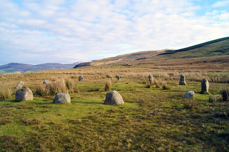
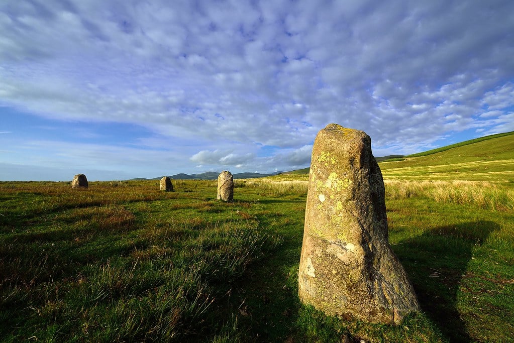
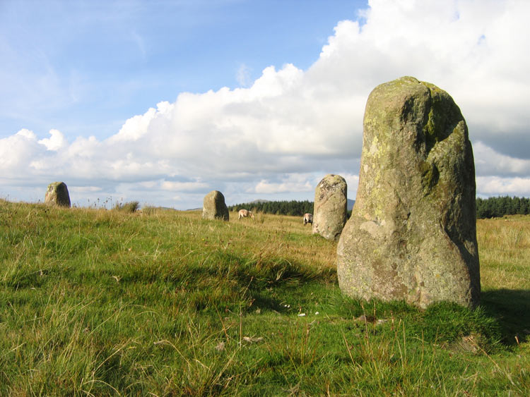
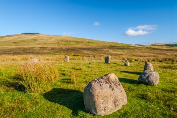
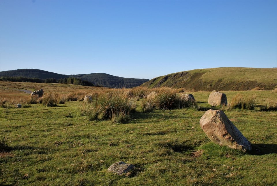
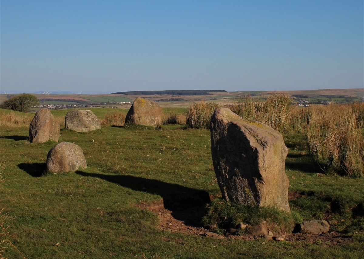
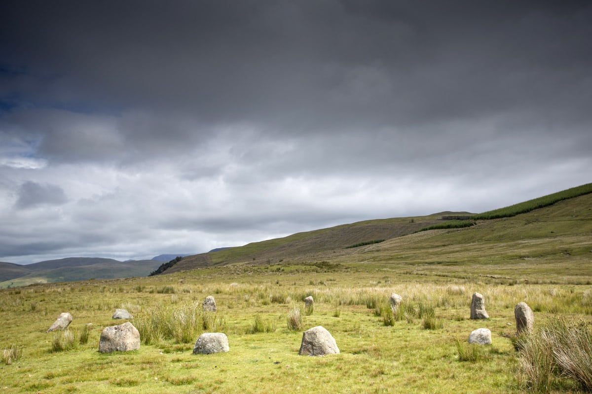
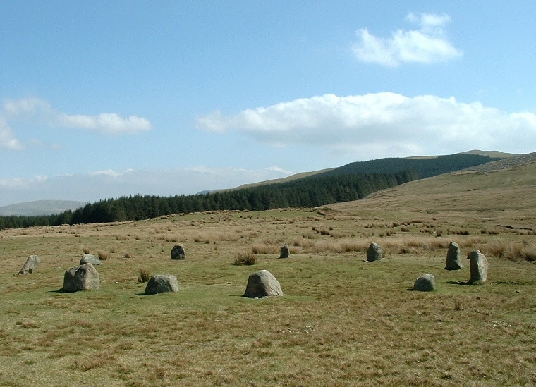
Blakeley Raise Stone Circle, also known as Kinniside Stone Circle, is situated on a plateau of land known as Blakeley Moss in Cumbria, England. The circle is about 18 metres in diameter and consists of 11 stones, with the tallest measuring only 1.5 metres in height. The stones are made of granite and are arranged in a ring, with the circumference of the ring being about 15 metres wide.
Entrances
There are possible entrances in the circle at the south and north-west. The entrances are not well-defined and may have been created by the removal of stones. The south entrance is aligned with the midwinter sunset, suggesting that the circle may have been used for astronomical observations.
Sockets
The stones are set in sockets, which were created by digging shallow holes in the ground. The sockets are not well-defined and vary in size, suggesting that the stones were not carefully selected for their sockets.
Gateposts
There are two gateposts located outside the circle, one on the east side and one on the west side. The gateposts are made of granite and are similar in size to the stones in the circle. It is not clear whether the gateposts were originally part of the circle or whether they were added later.
In summary, Blakeley Raise Stone Circle is a small circle composed of 11 granite stones arranged in a ring on a plateau of land known as Blakeley Moss. The circle has possible entrances in the south and north-west, and the stones are set in sockets. There are two gateposts located outside the circle, but it is not clear whether they were originally part of the circle or added later.
Restoration
The Blakeley Raise Stone Circle is a Bronze Age monument that has undergone restoration to preserve its original state. The restoration work was carried out by a working party in 1925. Several stones had been removed from their sockets and used as gate posts by a local farmer. The restoration involved cleaning out the stone’s sockets and concreting the stones back in place.
Reconstruction
The Blakeley Raise Stone Circle has been sympathetically reconstructed, with excellent views. The circle is situated next to the fell road from Ennerdale Bridge to Calder Bridge in Cumbria. The stone circle is locally known as Kinniside Stone Circle and was omitted from Ordnance Survey maps.
Concrete
The restoration of the Blakeley Raise Stone Circle involved concreting the stones back in place. The use of concrete has been a controversial issue in the restoration of ancient monuments. However, in the case of Blakeley Raise, it was deemed necessary to keep the stones in place and preserve the monument’s original state.
In conclusion, the restoration work carried out on the Blakeley Raise Stone Circle has preserved the monument’s original state and allowed visitors to appreciate its beauty and significance. The use of concrete in the restoration has been a contentious issue, but in this case, it was deemed necessary to preserve the monument’s integrity.
Significance
The Blakeley Raise Stone Circle, also known as the Kinniside Stone Circle, is a reconstructed stone circle in the civil parish of Ennerdale and Kinniside in Cumbria, England. It is situated next to the fell road from Ennerdale Bridge to Calder Bridge and is composed of 11 stones. The circle is about 18 metres in diameter, with the tallest stone measuring only 1.5 metres in height, but most of the stones are quite a bit smaller.
Views
Despite its small size, the Blakeley Raise Stone Circle offers stunning views of the surrounding landscape. The circle is built on a plateau of land known as Blakeley Moss, with the hill of Blakeley Raise rising up behind it. From this vantage point, visitors can see the Western Lakeland Fells, the coast, and the hills and moors of the surrounding area. The views from the circle are particularly impressive during sunrise and sunset.
Impressive
The Blakeley Raise Stone Circle may not be the most impressive stone circle in Cumbria, but it is still a fascinating historical and archaeological site. The circle is made of local granite, which is an impressive feat considering the weight of the stones and the distance they would have had to travel to reach the site. The fact that the circle has been reconstructed also adds to its significance, as it provides insight into how ancient people constructed and used these structures.
Overall, the Blakeley Raise Stone Circle is a small but significant piece of Cumbrian history. Its location on Blakeley Moss offers stunning views of the surrounding landscape, and its construction from local granite is an impressive feat. Visitors to the area should take the time to explore this fascinating site and appreciate its historical and cultural significance.