




Peaks & Fells / Rampsgill Head
LAKE DISTRICT FELL GUIDE
Rampsgill Head
An upland summit on the remote High Street and Martindale ridge. Discover its location, summit details, approaches and essential mountain safety information.
Last updated: 9 November 2026
Approx. height
792 m / 2,598 ft
Area
Far Eastern Fells · Hartsop or Martindale
Walking character
High fell terrain · experienced hillwalking
Why visit Rampsgill Head?
An upland summit on the remote High Street and Martindale ridge. The summit lies at OS grid reference NY 44227 12772; its approximate WGS84 position is 54.507176, -2.862853. These coordinates identify the summit, not a safe route or roadside access point.
Clear conditions can reveal sweeping views across surrounding ridges and valleys. Weather and route choice can make the same mountain far more challenging than its height alone suggests.
Walking routes to Rampsgill Head
The following are known approach options, not turn-by-turn directions or Lake District Offers GPX files. Plan a complete walk with a current OS map and assess ground, distance, ascent and daylight.
Approach from a valley start
From Hartsop via Hayeswater and the High Street ridge. Check the approach and return carefully, including any steep or loose sections.
Alternative ridge approach
From Martindale via High Raise and Kidsty Pike. A ridge crossing may add considerable distance and ascent; allow time for changing weather and a safe descent.
Terrain, exposure and navigation
Rampsgill Head involves exposed Lake District fell terrain, with potentially slippery rock, loose stone, steep ground or poorly defined paths depending on the route. In mist, summit and descent navigation can be difficult. Carry a map, compass, warm and waterproof layers, spare food, water and a headtorch. Winter conditions may require additional skills and equipment.
Check the latest weather and travel alerts and mountain-specific forecasts.
Rampsgill Head in photos
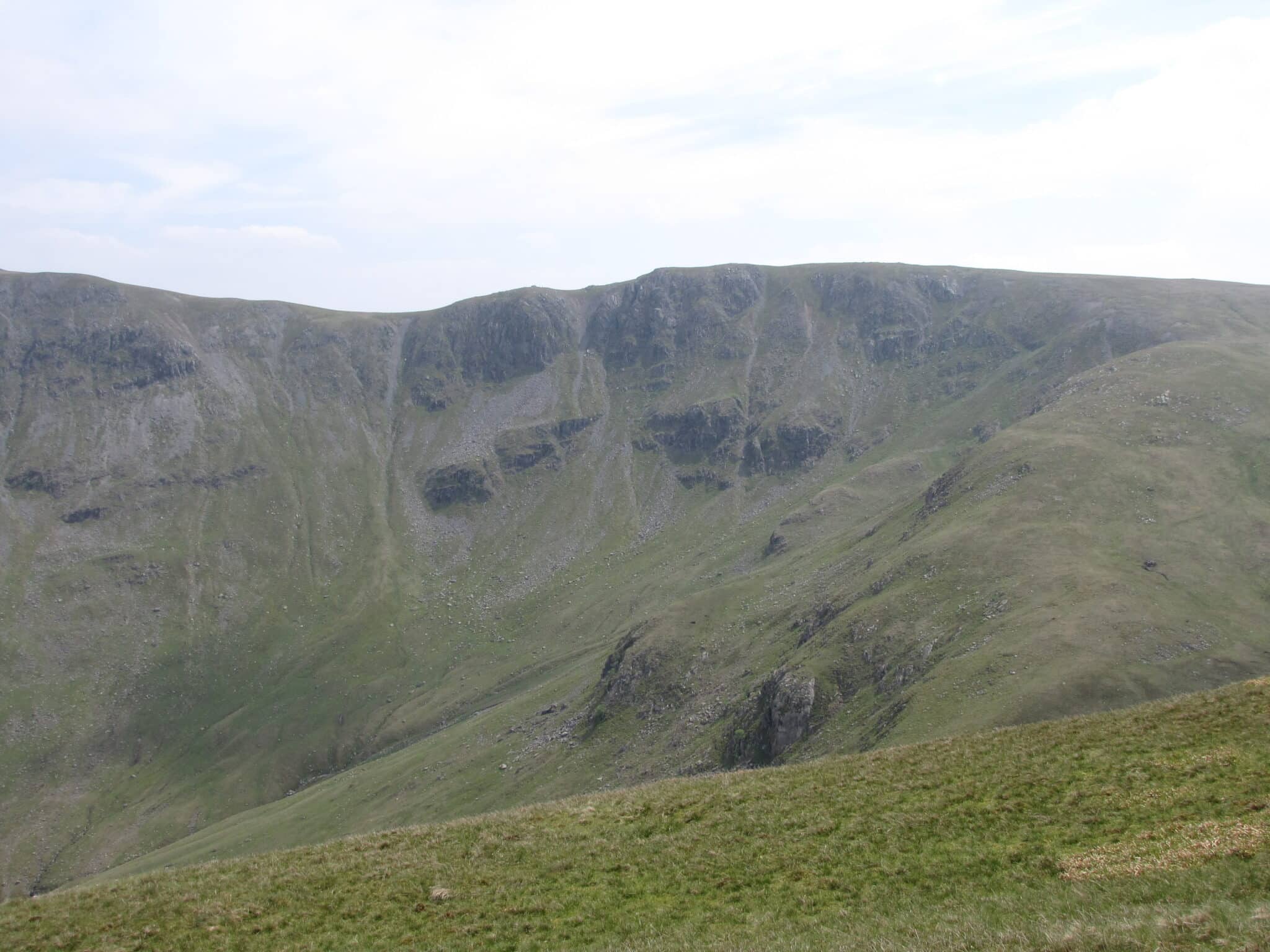
Rampsgill Head photographed in the Lake District. Visibility and conditions may differ from those shown.
Getting to Rampsgill Head
Access areas: Hartsop or Martindale. Follow a researched route from a suitable legal starting point, and check public transport and parking locally.
Summit: NY 44227 12772 (latitude 54.507176, longitude -2.862853). These figures are not parking coordinates.
Check conditions before your walk
Choose a route suitable for every walker, carry appropriate equipment and let someone know your plans. Allow for slower progress over rough ground and never assume a phone signal is available.
Rampsgill Head: useful questions
How high is Rampsgill Head?
Approximately 792 metres (2,598 feet).
Is Rampsgill Head a Wainwright?
Yes, in the Far Eastern Fells.
Where is the summit?
NY 44227 12772, at approximately 54.507176, -2.862853.
Where do walks begin?
Hartsop or Martindale provides possible access areas; choose a complete mapped route before travelling.
Is the climb easy?
It is a high-fell outing. Technical difficulty depends on the chosen approach and prevailing conditions.
Explore other Lake District fells
Places to stay near Rampsgill Head
Consider accommodation around Hartsop or Martindale, depending on your starting point. Always check the distance to the actual trailhead.
Find hotels, inns and other accommodation in our places to stay directory. Availability and journey times vary.
Some property pages contain affiliate booking links. We may earn a commission from qualifying bookings at no extra cost to you.