




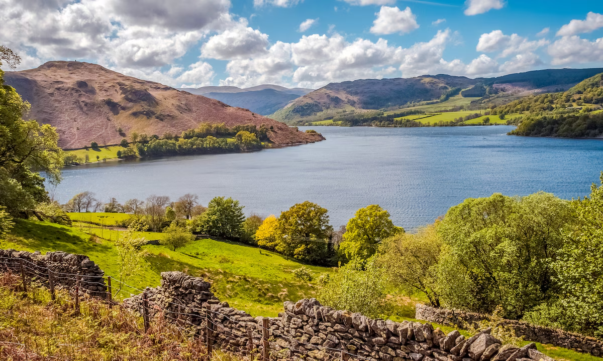
Catch a boat across Ullswater to Howtown, then walk back to Pooley Bridge through open countryside with wonderful lake and fell views. This section of the Ullswater Way is a rewarding half-day outing, with lower and higher route choices.
Why walk from Howtown to Pooley Bridge?
This walk combines the pleasure of an Ullswater boat journey with a quieter stretch of countryside on the lake’s eastern side. You’ll enjoy broad views across the water, farmland and open fell, before finishing among the cafés and pubs of Pooley Bridge.
Our walk: start with an Ullswater Steamer
On our previous visit we arrived early in Pooley Bridge, parked up and had time to pick up picnic supplies. Granny Dowbekins Tearooms was a tempting option for breakfast before we headed to the pier and boarded the Ullswater Steamer for Howtown. Taking the boat first makes this a particularly enjoyable linear walk.
Check the latest steamer timetable and ticket arrangements before travelling. Sailings vary by season and weather. Do not assume a regular bus serves Howtown pier, or that parking is available there.

The route from Howtown
From Howtown pier, pick up the signed Ullswater Way towards Pooley Bridge. The route climbs away from the landing stage and crosses a mixture of farmland and more open ground, with regular opportunities to stop and look back across Ullswater.

Lower route via Cross Dormont
The lower choice passes through working farmland towards Cross Dormont and Waterside House. Be alert for livestock, gates and uneven ground. There is a short road section of approximately 500 metres on this option; walk carefully and face oncoming traffic where appropriate.
Higher option via The Cockpit
A higher alternative crosses open moorland towards The Cockpit, a prehistoric stone circle on Askham Fell, before continuing towards Pooley Bridge. It is not a compulsory midpoint on the lower route. The higher ground is more exposed, so allow extra time and use a proper route map.
Hallin Fell and Bonscale Pike are separate fellwalking objectives rather than required climbs on this route. Avoid treating them as waypoints unless you have deliberately planned a longer walk.
Finishing in Pooley Bridge
The village at the northern end of Ullswater is an ideal place to finish, with refreshments and accommodation nearby. You’ll find places to eat and drink, including local pubs, as well as the pier for further Ullswater outings.

Practical tips before setting off
- Footwear: Choose walking shoes or boots with good grip; the ground can be muddy or slippery.
- Weather: Carry waterproofs and an extra layer even when conditions look settled.
- Navigation: Use the official route information and an OS map; do not rely on mobile signal alone.
- Dogs: Keep dogs under close control around livestock and follow local signs.
- Accessibility: Expect uneven paths, gates and possible stiles; this is not a step-free walk.
- Transport: Confirm steamer operating days, departure times and return arrangements in advance.
Make a break of it: stay in Pooley Bridge
With Ullswater on the doorstep, Pooley Bridge makes a useful base for walking, boating and exploring the eastern Lake District.
Check Pooley Bridge accommodation deals
Affiliate disclosure: we may earn a commission from qualifying bookings at no additional cost to you.
Frequently asked questions
How long is the Howtown to Pooley Bridge walk?
Our downloadable Lake District Offers GPX measures approximately 7.24 km (4.5 miles) for a digitally planned route using mapped paths and tracks. Other variations of the Howtown to Pooley Bridge walk, including the higher route via The Cockpit, may be longer. Allow roughly 2½–3½ hours plus stops. The GPX has not been field-verified; check rights of way and current conditions, and carry a suitable map.
Can I get a boat to the start?
Yes, on dates when Ullswater Steamers operate between Pooley Bridge and Howtown. Always check the published timetable before planning your walk.
Does the walk go through The Cockpit stone circle?
Only if you choose the higher moorland alternative. The lower route does not require a visit to The Cockpit.
Is the walk suitable for beginners?
Walkers comfortable with moderate distances, uneven ground and some climbing may enjoy it. Carry navigation, wear suitable footwear and check the weather.
The other three Ullswater Way stages
This walk completes the four-stage Ullswater Way circuit. See our individual guides for Pooley Bridge to Aira Force, Aira Force to Glenridding and Glenridding to Howtown, or explore the full Ullswater Way overview.
Distance note: the published Ullswater Way stage is approximately 8 km, while our existing downloadable GPX represents a particular digitally plotted 7.24 km variation. Check your intended path and do not assume the figures describe identical lines.
More to explore: Ullswater · Howtown · Ullswater Steamers · Official Ullswater Way information